
By Tina Fisher Forde
The Forde Files No 62
Bay Delta Conservation planners on 12-city tour
The Forde Files
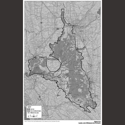
An outline of the Sacramento Delta area included in the conservation proposal
Developers of the proposed Bay Delta Conservation Plan, now in a 120-day public comment and review period, are on a 12-city trek around the state to explain the ambitious project to the people.
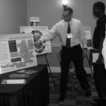
On its second stop, Jan. 16 at the Four Points Sheraton in Bakersfield, visitors were treated to free glossy publications, CDs of the environmental impact reports (EIR/EIS), a court reporter to take public comments, a roomful of well-executed posters and about 20 project team members from various government agencies and consulting firms eager to answer questions.
While Forde Files was there, planning staffers outnumbered visitors, and it was a journalist's candy shop, with all the experts on hand in one room. Visitors will no doubt increase in the other cities adjacent to the conservation area or more directly impacted by the project –Sacramento, Stockton, San Jose – as the controversial plan is emotional for residents and farmers who live within the proposed boundary.
The massive project is designed to make the water supply more reliable and to restore the levee-laced ecosystem of the island-dotted delta, which drains the major rivers of Northern California into San Francisco Bay. A third goal is, as the planners define it, "climate risk adaptation" -- that is, to avoid catastrophic levee destruction caused by earthquakes or rising sea levels. Based on hydrology models extending to the end of the 50-year permit period in 2060, the planners expect that water under the Golden Gate Bridge will have risen a foot and a half, which in turn will push salt water farther into the delta. Planners predict that without mitigation, the rising water would wreak havoc on levees and islands that even now are below sea level.
"That's the disaster we're trying to avoid," said Nancy Vogel, public affairs director for the California Department of Water Resources.
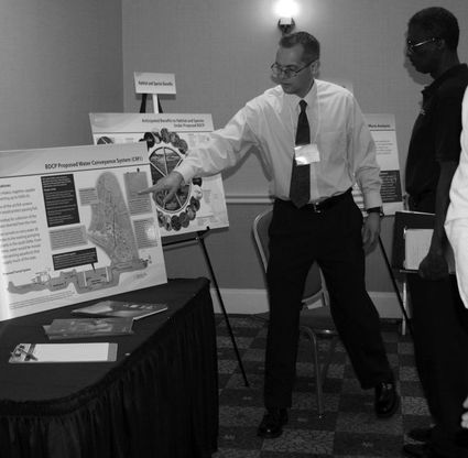
a project staffer explains a point to a workshop visitor at the Four Points Sheraton, Bakersfield, Jan. 16
The planners are proposing the construction of three new intake pump stations at the northern end of the conservation area, fitted with modern fish screens to protect the migrating salmon. Two 30-mile gravity flow tunnels would send the water south. Two pump stations – one state and one federal – now exist at the southern end of the area.
As for how the project would impact the water available to the Tehachapi-Cummings County Water District through the State Water Project, the vision is a bit murky. It appears to depend on how well the fish populations thrive. The project, Vogel said, "provides more opportunities to move water so it won't harm the fish. It will not increase anyone's water supply. It could decrease water delivery from the Delta five percent less or more than the historical average, which is 5.2 million acre feet. What dictates it is biological considerations."
The planners have not worked out who will manage the conservation area.
"The notion is there will be public access," Vogel said. "The species will come first, of course."